We need to fix how Birmingham's cycle routes are mapped and signed
Ever wondered where the magical road cycle symbols lead to? Or why tram stops apparently have a cycle track looping around their platform?

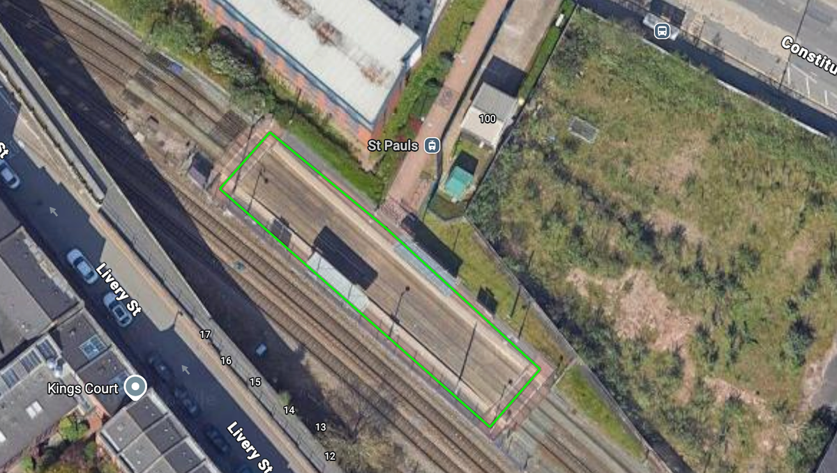
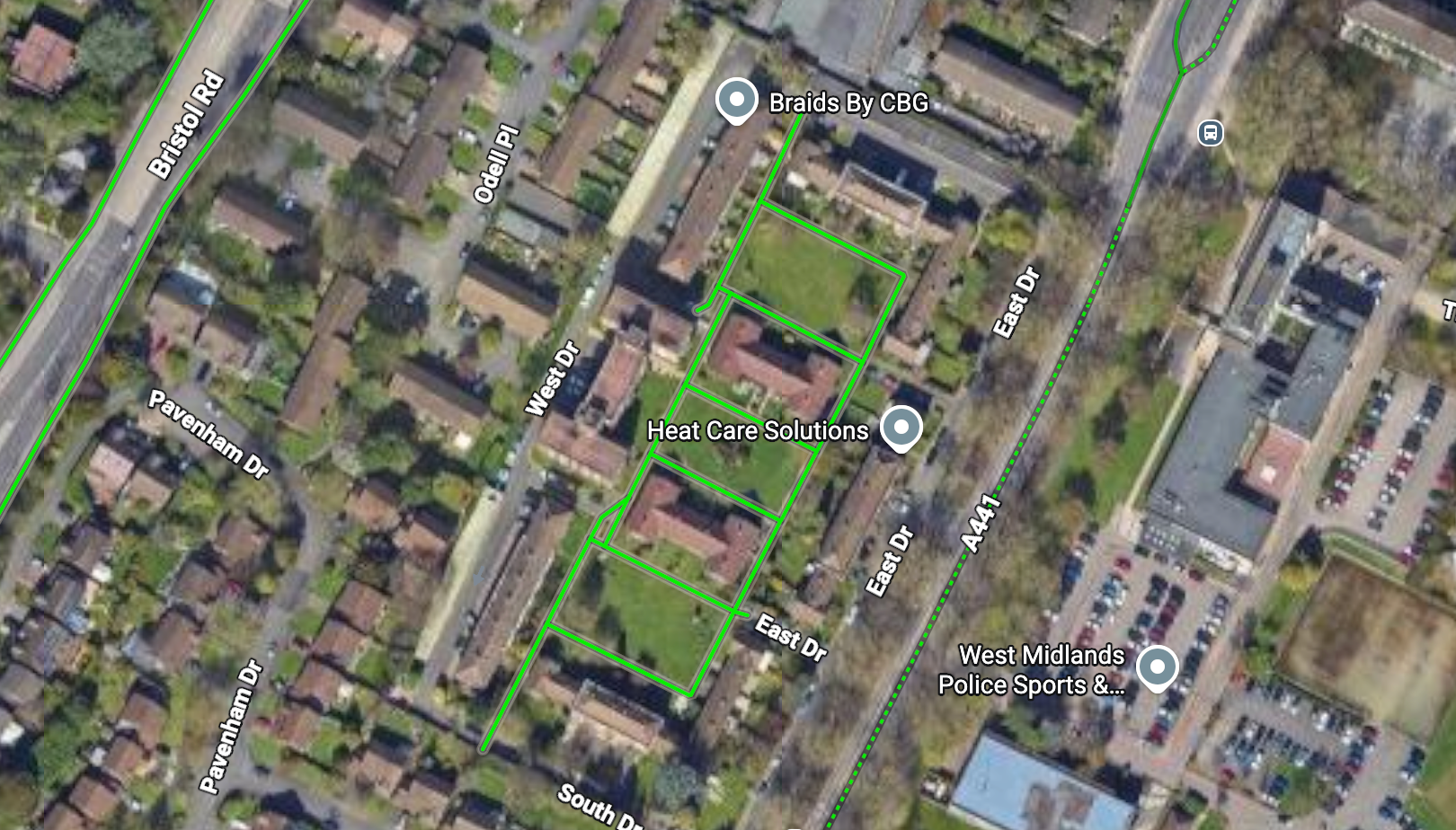
Earlier this year, I started to notice that Google Maps has created cycle routes based on a dodgy algorithm: private gardens, hospital paths, tram stops and random back alleys, while not identifying long-established routes.
Laura Laker has picked up on this in London, publishing a piece asking Has Google Maps failed in London? Not Just Bikes have recently explored why Google Maps fails in Amsterdam.
I’ve come to the conclusion that Google Maps has failed in Birmingham as well. When the platform’s not screwing up its mapped cycle network, it's establishing rat runs through residential areas - which could be addressed through collaboration and technical choices - and showing overly-tech-reliant drivers the wrong speed limits.
When trying to plan new cycle routes, I got so frustrated by the dodgy routes.
Sometimes, I'd find white bikes painted on the road (called sharrows) which were entirely meaningless as there was no signage to explain what route you were on or where you could go if you followed the bike symbols.
I'm not alone in getting annoyed by a lack of signage. According to 2023 research, signage is something that 64% of Brummies surveyed say would help them to cycle more.
Birmingham's cycle routes are well-documented in council strategies, yet are totally missing from satnav apps like Google Maps, Apple cycling directions, or open-source alternatives usually based on OpenStreetMap data.
So I decided to get my head down and create a map for myself.
What I found when mapping
Birmingham has (at least) 307km of routes but they don't come together as a coherent network:
- Cycleways - Modern routes separated from traffic, disconnected from each other - 19km
- Quietways - Routes in the carriageway on quieter residential streets, previously rolled out as ‘parallel routes’ as part of the Birmingham Cycle Revolution - 97km
- Greenways - Routes using shared paths through green spaces like parks, which might be secluded or unlit, usage dips when dark due to lack of personal safety - 112km
- Waterways - Routes on shared canal towpaths, shared with pedestrians and again usage drops at night due to lack of personal safety - 60km
- Roadways - Routes in the carriageway of busy main roads, with some sections of white line lanes along a pavement - 19km
Shared paths aren't mapped unless part of a wider route. Most aren’t well-designed and randomly stop with a useless ‘end of route’ sign.
In the analysis, I found more of a network than I was expecting but there are still vast swathes of the city without access to a cycle route. Mapping and signage cannot fix this. That's why we need to build new routes to give more people safe access to cycling. It's also for another post.
The difference is stark
When you cross-compare Google with a manually plotted map, you can see a huge difference between what exists versus what Google has mapped.
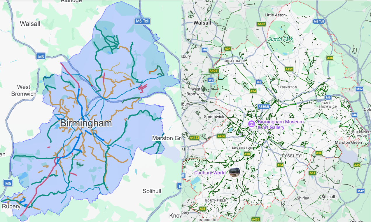
Bad map data isn’t new. From what’s below our feet to what’s above our heads. Construction sites and transport projects uncover unexpected utilities all the time. Map-based speed limits often show up wrong in newer cars. It’s all a best guess based on the available information.
As a cyclist, poor data is made worse by the street experience: cars parked in cycle lanes and filters, wrong or missing signage, worn down road markings. Most people living on a quietway route probably have no idea it exists.
I tried to follow the quietway from Birmingham City Centre to Handsworth Cemetery (which then takes you to Sandwell Valley Country Park). The route was a slight mixed bag, and could use some improvements, but it was mostly fine if only I didn't keep getting lost through the lack of signage.
Without an obvious route, you turn to a tool to plan the best route for where you need to go. But we know Google Maps and other tools show bad and non-existent routes, while missing the good and preferred ones.
Why did it go wrong?
Councils are only legally responsible for keeping a definitive list of streets, public rights of way, street works and traffic regulation orders. It might be unsurprising that keeping people like Google up to date was less of a priority during the austerity era.
Organisations have resorted to creating their own maps - for example, ecobirmingham’s excellent 69 wards map.
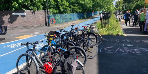
In the meantime, Google has clearly decided to algorithmically identify cycle routes, resulting in a disconnected and frankly wrong picture of the infrastructure: garden paths, tram stops (like St Paul's stop shown in the featured image - here's what it looks like on the ground), and wrongly identifying dual carriageways as 'bike-friendly roads' despite really having no cycling infrastructure whatsoever.
Satnavs influence route planning for both individuals and increasingly businesses - for example, when you’re riding a Lime bike or e-scooter, food couriers and, shortly, parcel couriers like Royal Mail and Amazon.
In the last decade, Transport for West Midlands even had to commission an external provider to map the region’s roads by sending a car to record every street to create an accurate record of banned turns, loading and waiting restrictions.
How can we fix it?
In Birmingham, it is clear that we need to wipe the virtual maps clean and start again. Who should build and maintain the map of routes is another question entirely.
A national commitment to make mapping better
Nationally, the Government has committed to mapping ‘safe’ cycle routes across England by 2030, as part of its third Cycling and Walking Investment Strategy (CWIS3).
However, 'safe' is not qualified. Does safe mean full LTN 1/20 compliance, for example? Much of the National Cycle Network isn't very safe and non-compliant, as documented in Laura Laker's Potholes and Pavements.
How we can support the national map
WMCA is about to publish an updated West Midlands Local Cycling and Walking Infrastructure Plan as well as a new regional Local Transport Plan (WMLTP5).
This is an opportunity to commit to supporting Active Travel England with the creation and maintenance of our region’s cycle route data.
We also need to get the basics right
We also need to make sure that when new road schemes are completed, cycle data is included in what is updated.
For example, as of last year, Waterloo Street has a contraflow cycle lane. Looking at mapping alone, there’s no indication of being able to cycle contraflow despite the reversal of the one-way system for cars being implemented. The same can be said for the 30mph speed limit changes last year.
So we need to make sure online mapping is definitely part of project checklists. And that the data is uploaded in the correct format for use.
An opportunity to introduce route numbering?
CWIS3 also commits to rolling out more consistent signage and road markings. This could be an opportunity to number brand our routes, rather than the few that happen to be part of the National Cycle Network.
When I mapped cycle routes, I had a go at establishing a numbering system: 1 for the city centre, then 2 to 8 clockwise around the city. The number starts from the segment furthest from the city centre. This means you can be sure you’re heading in the right direction when starting in the centre.
The numbers would go up to three numbers: one number is a primary route, two numbers a secondary route, three numbers a tertiary or leisure route.
Routes start with a letter that describes the type of the cycleway it is, for example, C for cycleway or R for roadway, with the letter being the worst quality the lane becomes along the route.
Admittedly, this becomes awfully complicated on both a regional and national scale, but has been overcome through the road classification system in the UK and on national levels abroad.
Signing routes better
Installing better signage would help people know where cycle routes lead to. Birmingham has patches of good cycle signage, especially for new routes, however also has vast deserts.
It’s something that Better Streets for Birmingham includes in every consultation response relating to cycle infrastructure. How are people supposed to know where they can go and how long it will take? The Legible London pedestrian wayfinding system made London more navigable without the need for transport and made places feel closer together in order to walk or cycle the distance.
My favourite example is just outside the city centre near the old City Hospital campus. If you cycle onto Clissold Street from Capstone Avenue, you would have no idea that you can turn left to get to Port Loop, Summerfield Park or Harborne, or if you turn right you can get to Winson Green, Gib Heath, Handsworth, Soho Road, Holyhead, Perry Barr, Perry Hall, Aston or Sandwell Valley.
Or if you’re in the residential area of Sparkhill, that one way you’re a couple of minutes’ cycle from the city centre one way, or can get to Acocks Green, Hall Green, Yardley Wood, Hasluck’s Green the other way. They’re just magic cycle symbols that might go somewhere.
Or that on Hurst Street, should you turn right, you will get to the city’s premier cycle route (when not occupied by construction), which is soon to be extended to 11km. This reaches much of south west Birmingham. It also now happens to be part of the National Cycle Network Route 5.
And as for Google Maps?
Google Maps needs to work out that it sucks for cycling as well as fixing its false cycle paths. I'm not sure how to tell them this. I've commented on LinkedIn posts from their staff. I've given product feedback. I've reported bad data.
When Active Travel England's mapping work is published, Google (and others!) needs to implement it thoughtfully and remember that cyclists needs are different to motorist needs.